The Democratic Socialist Republic of Sri Lanka (formerly Ceylon) is an island in the Indian Ocean, separated from south-east India by the Palk Strait. It is almost linked to the Indian mainland by Adam’s Bridge, an atoll barrier, mostly submerged, lying between the offshore island of Mannar and India itself. The country comprises of nine provinces with a total area of 65,610 sq km.
With the highest literacy rate in the South Asian region and English being the second language, most of Sri Lankan people can handled English well. Which will help foreign students and staff to affiliate with local people and its setting. The whole country has internet access, which will help to stay in touch with the outside world. Also, the improved transportation facilities will take you anywhere in the country within short period of time.
Being Island it ideal for Beach Holidays. The 2 major monsoons affects the two separate areas of the country, leavening half of the beach area accessible throughout the year. Area of 65,610 Km2 is relatively small. Anyone can Travel across the country (on land) within couple of days. Coastline and sea around the country offers endless touristic opportunities.


Sri Lanka has thousands of years old Ancient cultural heritage. Anuradhapura, Polonnoruwa, Sigiriya and Kandy are few of ancient cities in Sri Lanka with resemblance to proud royal history. In addition, there are living cultures in Sri Lanka. Any part of the country there are unique cultural aspects to be experienced.
The difference in topography & rain fall a unique climatic experience in various parts of the country that gives the opportunity to experience different types of Eco-Systems with close proximities. Beyond the coastal plains, Sri Lanka’s topography is dominated by an outstandingly beautiful central mountain massif of gneiss rock, with the highest point at Pidurutalagala. The holy Adam’s Peak is so called from a mark at the top in the likeness of a human footprint, variously attributed as the print of the Buddha, Vishnu or Adam, and is a place of pilgrimage. The coastal plains are broader in the north, tapering off in the long low-lying Jaffna peninsula. Several fast-flowing non-navigable rivers arise in the mountains. The Mahaweli Ganga, from which hydroelectric power is obtained, is the longest at 322km.
Nature reserves in Sri Lanka cover 10% of the island. Wilpattu National Park in the north-west is best known for leopards. Yala National Park in the southeast is home to large elephant populations.
Padukka is a town in the district of Colombo in the Western Province of Sri Lanka. It has a population of roughly 8,000. It is situated 33 kilometers east of Colombo, the commercial capital of Sri Lanka, and on the bank of Pusweli Oya on a high ground surrounded by marshland.
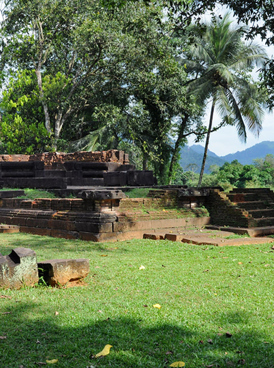

The town of Padukka is thought to have been founded as a campsite by the forces of the Seethawaka Kingdom in the 16th century CE, on the banks of the Pusweli Oya (a major tributary of Kelani Ganga river). It was a well-protected site with marshland and hills surrounding the site. Legend says that the town got its name as it was under the “Naa”(Iron Wood) Trees in the town that the Portuguese Army rested after being defeated by the Army of King Seethawa Rajasinghe in the battle at the adjoining Hanwella Fort. It was said that the defeated Portuguese army rested there until they settled their minds. Thus in the Sinhala Language it was called “Paha Dukka” (“paha”= vanish; “dukka”= sadness), which became “Padukka” later. The famous “Naa”(Iron Wood) Trees are still present at the town’s rest house premises. Angampitiya which is just 4 miles from the city centre is believed to be the place where king observed the kind of martial art known as Angam Poraya.
Padukka can be accessed via highway (33 km from Colombo) or by the Kelani Valley Railway Line. Seethawaka botanical garden and Labugama Kalatuwawa Forest Reserve are few of the places with natural beauty in Padukka region.